La Marmotte

I was pretty tired after the last 10 days of climbing, and Alpe d’Huez had been bloody hard work on Wednesday, so I was worried that maybe I’d overdone things in the run up to the big day. I did nothing on Thursday and then on Friday I went for a 40min cruise along the valley floor followed by a dip in the local swimming pool featuring some spectacular views from the water. Friday evening was spent giving the bike the once over, fitting my transponder and race number and making sure I had all my gels/powders packed and ready to go for the morning.

The alarm went at 5.30 and it was followed by a quick shower, down to breakfast and an attempt to force-feed myself in preparation for a big day. Pre-race nerves (in a good way) usually mean that I have bugger all appetite in the morning, but I knew it was important that I load up for the day ahead as I’d never be able to eat enough along the route to keep up with energy demands. Once that chore was complete I threw the bike in the back of the car and drove down to the main road. There was no way I would be able to ride the 10km climb back to the guest house at the end of the day!!

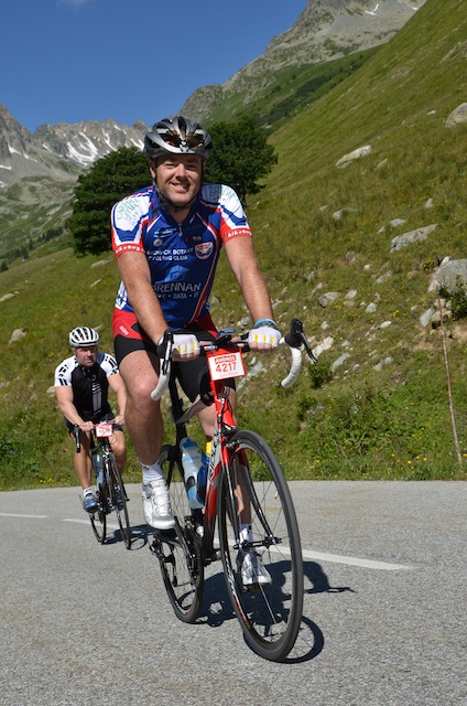
With 7,000 participants or so, start times are staggered with the first group off at 7, the second at 7.30 and the final group at 8. Out of the guys in the house, Dan & Simon were in the first group, Giles the second and myself and the Irish lads were in the final group. Hugh and Joe were aiming to crack eight hours which was way too fast for me, but Conor and Cormac had been climbing at my pace up Col du Glandon so we’d probably end up together. We joined the back of the 8am start queue and slowly shuffled forwards, crossing the start line at 8:11 with 174km ahead of us.

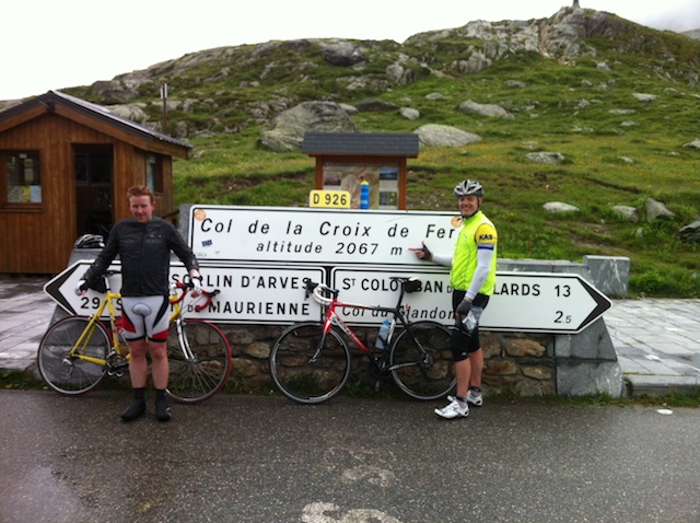
I’d worked out split goals based on the recon rides I’d done and had taped them to my bike’s stem. The descent off the Glandon was time neutralised as it’s considered too dangerous with so many riders still bunched together early in the event. Bearing this in mind, I’d structured things to aim for a finish time of 11hrs, which, when the descent was subtracted, should mean I’d attain the silver medal goal time of 10h20 for my age group. That was all ahead of me as I left Bourg, hitching on to a line of Dutch guys flying towards Allemond. I may have been taking it easy, but I figured I might as well take a tow if one was being offered. After the quick zig-zag up the Barrage there were a couple of flat kilometres and then we were into the first climb of the day, Col du Glandon (profile). I could see Conor and Cormac a bit below me as they hadn’t jumped a Dutch train, but I figured they’d catch me on the climb so I kept going at a nice comfortable pace, keeping the legs spinning over and using the power meter to pace myself. Having ridden the climb a days ago was a big help, as I knew where the tough bits were and could adjust accordingly. Also, it wasn’t raining like it had been on Monday which was a big help, as was the fact that there were so many other cyclists around. As a result I made it to the top with 2h20 on the clock, almost 25 minutes ahead of schedule and I’d been riding easier than on Monday.

Wary of going out too hard, I opted to take my time at the food station on top. The French know how to do race food and there were baguettes, salami, brie, fruit (fresh & dried) and jellies on offer. I spent 10 minutes eating a bit of everything and refilling water bottles before hitting the descent. Although it was neutralised I pushed it a little bit, simply because it was fun and there weren’t many people around me so it wasn’t crowded and I could choose my line. It was still a bit sobering to come across an ambulance blocking the road where an unknown rider had obviously come a cropper, and we had to carry our bikes through a field to get by. Once the descent was over I faced a 20km run to the base of the next climb at St. Michel de Maurienne. It’s a false flat, very slightly uphill, so the recommendation had been to get into a group and get a tow rather than slogging it out on your own. A few hard efforts saw a few of us latch on to a peloton in front and I just tagged along for the ride from then on. I’d been on the road for more than three hours at this stage and was feeling good, though the combined might of the Telegraphe & Galibier was on the horizon so it was a case of drinking regularly and saving the legs as much as possible.

As we arrived in St. Michel de Maurienne I stopped for a water bottle refill and checked my times. Bang on four hours meant I was still 30 minutes ahead of schedule, despite dawdling at the top of Glandon so I was pretty happy starting the Col du Télégraphe (profile). Again, the recon rides were invaluable as I knew this was a fairly easy climb with a predicable gradient so I settled down to a comfortable rhythm, kept sipping away at my drinks and kept on keeping on. I still prefer to ride a while, stop for a quick stretch and repeat, rather than riding non-stop, so I was slowly passing the same people over and over again. Nevertheless I was still feeling good and climbed the Télégraphe in 1:08, the same time I’d taken on my recon ride. It had taken me 3h50m to climb the combined Télégraphe/Galibier on Tuesday, including a 20m stop at the top of the Télégraphe and a 30m coffee stop at Plan Lachat, so I’d allowed myself 3h30m for the combined climb during the Marmotte, resolving that I wouldn’t be having any lazy stops en route.

After a coke and a stretch I headed off on the short downhill to Valloire, followed by the short climb to the second refuelling stop of the day. I was still facing 15km to the top of the Galibier (profile), so this was another leisurely stop, making sure I ate enough, though time got away from me a bit and I ended up arsing around for ten minutes, slightly longer than planned. The next target was the coffee shop at Plan Lachat which was reached after 40mins of solid climbing, at which point I sat on my arse for another 9 minutes, psyching myself up for the tough final 8km to the top. I was starting to get a little tired by this stage. Nothing serious, but I was looking forward to the summit as I knew there was more than an hour of descending after that before tackling the Alpe. I was also a bit apprehensive about the super steep section from the tunnel to the summit - it was tough enough on the recon ride without starting it with 100km+ and nearly 4000m already in my legs! There was amply opportunity for it to play on my mind as I approached it at a glacial pace, but, once there it wasn’t as bad as expected. In fact, it seemed easier than on the recon ride, probably because I’d been building it up too much over the previous half an hour. The summit loomed and I was greeted by an unexpected food stop. My bike computer read 7h30, so I was still half an hour ahead of schedule, giving me ample time if it all went to shit on the Alpe.

More food, this time with second helpings as I had over an hour to digest on the descent back to Bourg. The first part of the descent is steep and a bit narrow until you get to Col du Lauteret, after which it’s main road all the way back to Bourg. The roads weren’t’ closed to traffic, but all the cars were well aware that bikes (lots of them) were around and we pretty much were given priority. Frence drivers are generally awesome around bikes and don’t mind waiting behind you until it’s safe to pass, but with me hitting speeds up to 70km/h I didn’t have to worry about holding cars up. I did have to hold myself back a bit though, as I found myself powering out of turns and figured I’d be better off saving my legs for the final climb up Alpe d’Huez (profile).

I reached the final food stop at the base of the Alpe in 8:51, almost 40 minutes ahead of schedule and was still feeling reasonably good. I had a quick stop for a handful of jellies, refilled my water bottles and got going. No time to dawdle with the Alpe ahead of me as I knew that there was no respite from here to the finish line. The first two kilometres are over 10%, then it settles down to average around 8% for the rest of the climb, so if things went bad and the day caught up with me, I could lose serious time struggling to the finish. From doing the recon ride I knew where the water stops were and knew roughly the sections where the gradient would ease for a few hundred metres, so I had a few targets in mind. First of those was to get the 10%+ section out of the way at the start. I’d climbed it at just under 290W on Wednesday, which was a bit too hard so I deliberately stayed well under that. I’d built some leeway into my schedule precisely so I’d have time up my sleeve for the Alpe, so it made sense to use some of it and the steeps felt a lot easier.

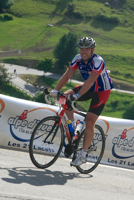
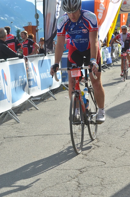
There are 21 hairpins on the way to the top, numbered in descending order, each signposted with the names of previous winners of Tour de France ascents of the Alpe and the water fountain outside the church at turn 16 signified that goal No.1 was complete; the 10% gradients were over and done with and I could now just settle into my normal climbing rhythm and hope it would get me to the finish. I was still stopping every 2km or so for a quick stretch, and mainly passing people rather than being passed which is always a good feeling. By the time I made it to the second church at bend 7 (Goal No.2) I was starting to feel the days exertions. I wasn’t so much tired as just over cycling. My arse was sore from so long in the saddle, my shoulders were stiff & tight and my knee and hamstrings were starting to stiffen up as well. Apart from all that, my legs still felt OK whilst actually cycling, so there was no fear of stopping, but my quick stretch stops were no longer having an effect and I was just willing the finish nearer so I could get off the bloody bike! Still, it was just mind games and minor niggles rather than exhaustion, so I kept plodding away until I finally crested the hump into the village where all the earlier finishers were sitting around, enjoying a beer and offering encouragement to those of us yet to do so. The village marks the end of the serious climbing, though there’s still a kilometre or so until the Marmotte finish, which feels flat, even though it’s between at 3 and 5%! Time to shift into bigger gears, get the speed up again, zip up the jersey and I crossed the finish line in 10:21:31, riding no-hands with a big smile on my face for the finish line photo, only later to discover that the bloody camera was quite a bit after the finish and it captured a more accurate portrayal of how I was feeling at the time :-)

That was it! I’d made it and was filled with a mixture of satisfaction at the accomplishment and relief that I could finally get off the bloody bike! After dropping back my timing chip I got a printed certificate with my official, adjusted time of 9:36:59, which was well inside the silver goal time for my age group, so I got to swap the €10 timing chip deposit for a nice silver medal. I also bought myself a souvenir bike jersey now that I’d finished, as I’m always reluctant to do so before completing an event, as there’s no point having a jersey or t-shirt for a event you didn’t complete. So, as the French say… FIN.

Stats:
10:21:31 total ride time
174.26km distance
4845m climbed
6062 calories burnt
69.9km/h top speed

Col du Télégraphe and Col du Galibier

My second ride in France saw me tackle the combined might of the Col du Télégraphe and the Col du Galibier. As the base of the Télégraphe is 90km from where I was staying, riding there was out of the question so myself and Jason drove to the top of Galibier, parked the car and got organised. Jason’s an Aussie guy staying in the same place as me, whose bike I recognised from seeing it outside Sutherland service station six months ago while I was on a Waterfall ride. It helps when your bike is a custom steel creation, handmade by Dario Pegoretti, one of the most famous bike builders around, with a one-off paint job. It stands out from the crowd, so I recognised it immediately when I saw it again hanging in the bike shed at our accommodation. Small world!

The ride started with a 35km descent to St. Michel de Maurienne which was great fun. Unfortunately they’d recently gravelled the bottom half of the Télégraphe so caution prevailed and the fun was over. After a plate of chips in a local restaurant it was time to turn around and ride the 35km uphill back to the car. From doing my research I knew that the Télégraphe was pretty civilised, at a fairly constant 7% gradient for 12km, then some downhill into Valloire before the Galibier itself started.

The kilometres ticked away, chatting to Jason about our various cycling experiences. He’s lighter and fitter than I am, but was also a bit wary of the climb so was happy enough to ride at my pace. The road is tree-lined the whole way up, so there’s no wide-ranging mountain vistas to take your mind off the climb and it’s just a question of putting the head down and slogging away at it. The gravel section was a pain in the arse as I could hear bits being picked up by my wheel and scraping through the small gap between tyre and the top of the forks. Maybe I would have been better off with the standard 23mm tyres instead of the 25mm ones I had? Unlike yesterday, the sun was out and it was nice and hot. No more rain to deal with. Also unlike yesterday, the Télégraphe has kilometre markers indicating both the average gradient and the distance remaining to the top where the Glandon doesn’t. This made it easy to gauge your effort and we were soon at the top, part one of the climb conquered.

I bumped into a guy, KKB, I knew from a triathlon forum I hang out on back in Oz who was over to do the Tour of Mont Blanc, a one-day, 330km ride with 8000m of climbing! He’d also been over two years previously to do Marmotte, though we hadn’t met then and he’d finished the event where I DNSed. Clearly Mont Blanc was the next step. Food for thought! He headed off up Galibier with his riding mates while we opted to grab a refreshing Coke and cool down a bit.

The ride resumed with a 5km descent into Valloire before the 18km of the Galibier started. Everyone says the Galibier is a beast of a climb, so I was a bit apprehensive starting out if I’m honest, and it seemed to ramp up straight out of town as a warning. Thankfully it didn’t last and relented to three or four percent for a few kilometres before returning to 7%. That was the easy bit out of the way and it was solid climbing along the valley from there on. The Tour de France had passed this way last year, so we passed plenty of graffiti painted on the road, encouraging various riders including this one for last year’s champion.

Shortly afterwards we reached Plan Lachat, 8km from the top. We’d been keeping an eye on the kilometre markers, which, along with the remaining distance, also indicate the current altitude. We know that Galibier tops out at 2645m, so some quick calculations showed that the remaining 8km was going to average close to 10%. By now it was getting bloody hot again, so we decided to stop for a quick rest and a refuel. We bumped into KKB and his mates again and ended up sitting there for half an hour chatting to various other cyclists, enjoying the sun and watching riders slowly zig-zag up the steep section ahead of us.

There was no point putting off the inevitable, so, while Jason went for a toilet break I took off since he’d quite happily outclimb me anyway. As it turned out, the gradient wasn’t that bad being only eight or nine percent, so I was able to plod along at a reasonably comfortable effort, stopping for the odd photo along the way.

One of the enjoyable aspects of proper climbing is the opportunity to look over the side and clearly see how much altitude you’ve gained in a relatively short space of time. The first few kilometres after Plan Lachat gave ample opportunity for this as they snaked their way up the side of the mountain. I could see Jason behind me, but didn’t appear to be gaining as quickly as I had thought he would. I passed a small shop advertising the local cheese and I wondered if they did much business at all. I couldn’t imaging anyone in my situation, slogging it up one of the Tour’s toughest climbs, stopping to buy cheese! The ride changed here, with the road now skirting along the side of a wide plain, though the gradient didn’t slack off at all. I knew the last two kilometres were the steepest and things were only going to get harder as the altitude continued to increase, so rounding a corner and finally being able to see the top wasn’t the joyous experience you’d expect.

Jason sailed past me at this stage with some Dutch rider in tow and there was no way I was going to ride at their pace so I left them to it. Not long afterwards I reached the tunnel, built so that car traffic doesn’t have to go over the top. For bikes, we skip the tunnel and turn left to be greeted by 12% gradients and some hard work to really earn the summit. By this stage it’s over 2500m and you can feel the altitude and, just to drive the point home, I ended up riding the last few hundred metres to the top through a cloud!

So, that’s three of the four Marmotte climbs out of the way. Only Alpe d’Huez left!

All Photos

Glandon and Croix de Fer

When I went to France two years ago for my first attempt at Marmotte, I’d buggered up my knee about six weeks before I left Australia. The first week of climbing went OK, but then I had three weeks off holidaying with Jacqui and attending Sean & Lisa’s wedding, then, when I resumed climbing, my knee gave out on the first, steep pitches of Col du Glandon. It was here, 15 minutes into the climb two years ago, that I finally decided to withdraw from Marmotte. Today was a big day as it would banish any lingering demons and disappointment from that day.

I’m staying up in Ornon with King of the Mountains (who I highly recommend) and have met a bunch of Irish guys from Kildare who are also here to do Marmotte. After farting around this morning waiting for everyone to build their bikes and replace the various bits and pieces they’d left at home, we all rolled out of Bourg just after lunch in the pouring rain. Big Joe and Hugh are the fit ones, so, once we’d passed Allemont and got onto the climb proper, they took off. Myself, Cormac and Conor were a similar pace, so we stuck together. They’d gain a few metres on me through the steep bits and I’d reel them back in once the gradient eased again.

The rain continued for a while before easing off. Cloud cover remained and temperatures stayed low which suited me just fine. After all the climbing in Italy, my legs were feeling good and the steep pitches which had stopped me in my tracks two years ago presented no problems this time. I spent most of this first part trying to figure out if I’d passed the point where I turned in 2010 but nothing obvious stood out and we soon reached Le Rivier d’Allemont which ended that train of thought. The ride profile indicated a short downhill after the village before climbing resumed but hadn’t mentioned the downhill gradient was 12%! Losing height mid-climb is always a pain in the arse and a steep gradient means a lot lost in a short space of time. All that effort wasted!

The first section of the climb out the other side was also steep at 11% for the first kilometre or so, before settling down to more manageable gradients. Towards the beginning of the climb we’d been passed by two trucks carrying full loads of live sheep, and, after climbing past a few more switchbacks, we were now greeted by those same sheep milling around the road, having presumably been dropped off in their summer paddocks. After a bit of messing around trying to manoeuvre through a herd which wasn’t sure which side of the road it wanted to be on, it was onward and upward towards the Lac de Grand Maison with the large dam wall initially greeting you before slowly revealing the lake itself.

At this point the view opens up (well it would have if it wasn’t so overcast and the clouds weren’t so low) and the road starts following the side of the valley at a consistent gradient instead of turning back on itself. There was another downhill section, though not as bad as the first, before the last pitch upwards to the Cols. Col du Glandon was the first to arrive, a short 200m detour to the left off the ‘main’ road. Cold and bleak, we didn’t linger long before getting back on the main climb for the few extra kilometres up to Col de la Croix de Fer. After the trophy photo we huddled into the café for a warm coffee before rugging up as best as possible for the cold, wet descent.


As we left the café the clouds closed in again, reducing visibility to less than 20 metres - not really what you want when trying to descend off an unfamiliar mountain on wet roads. We were soaked through as well, a combination of rain and sweat, so the first few kilometres were bloody freezing until we’d descended out of the clouds and the temperatures rose just a little. After that the descent was more fun, though what was a 12% downhill on the way up the mountain was now a 12% uphill into Le Rivier d’Allemont. I could have done without that to be honest. The last section was a blast, though we were stuck behind a van and couldn’t really make the most of it. By the time we’d made it back to the valley floor the temperature was up significantly and we rolled back into Bourg feeling a lot happier, if not actually any drier.

All in all a nice ride, but a bit of a warning as well. Col du Glandon is a tougher ride than it appears on paper and, as the first climb of the Marmotte, will have to be accorded its due respect.

Passo di Gavia

Day Two in Italy saw me riding Passo di Gavia, another famous climb from the Giro d’Italia, most notably Andy Hampsten’s ride in 1988 when he rode through a snowstorm to win the stage. Unlike ‘88, for me it was a beautiful, sunny day and, more importantly, the first few kilometers were an easy grade, giving ample time to ease into the climb.

Or so it seemed on paper! Prior to riding a climb I’d jump on Map My Ride, map the route and look at the elevation profile to give me an approximate of what to expect. However, on the longer climbs such as the Gavia (25km), the profile resolution isn’t great so there’s often some surprises. This was one of those times and I was struggling a little after a few kilometers on a pitch that was steeper than expected. Nothing serious, but 8% instead of 5% is enough to make you feel sluggish at the start of the day. The legs soon remembered what was expected of them and then the gradient eased up into Santa Caterina di Valfurva.

On the way out of town the ‘proper’ climb started with a few switchbacks and the road settled into a fairly typical 7-8% gradient. Whilst taking a photo I was passed, slowly, by a council truck who needed to do a three point turn to get around each hairpin bend, and I could hear his reversing beep for quite some time as he navigated the bends ahead of me, just out of reach. The Gavia is nowhere near as popular as the Stelvio, either with cyclists or motorcyclists and it was a quiet ride to the top passing only a few MTBers and a couple of runners on the way.

The top section is a relatively flat plain which just goes on and on before you reach the proper summit at 2652m in altitude. The ride plan foe the day called for doing both sides of the climb, so, after a leisurely refuel outside the café at the top I donned the windjacket for a fast and furious descent to the valley below.

Sixteen kilometres later it was time to turn around and head back up. This was always going to be a tough day and it wasn’t long before I was really struggling, facing a gradient of 16%. French road builders tend to plan things so that the gradient rarely goes over 12% but the Italians show no such restraint, with climbs like the mighty Zoncolan having sections over 20%. At 85kg I’m no climber and, even with my 32-tooth cog on the rear, once the gradient gets above 12% I’m quickly into the red zone. I’d noticed two signs on the way down, first for a 14% section and then the 16% one, so I knew what to expect in reverse. That didn’t make it any easier, though the spectacular scenery takes your mind off it, as do the narrow roads with barely room for a car and a bike side-by-side.

I have a power meter on my bike which tells me how much power I’m putting into the pedals. My average effort on medium grades is around 250W, and with a cyclist only being 23% efficient or so, this means that my body is actually generating over 1000W in order to put 250W into the pedals. The surplus is converted to heat which I then have to lose to prevent overheating, a task made more difficult as the mercury rises. With the temperatures now over 30C and the roads now above the tree line, I was keeping an eye out for suitable places to get a bit of shade for a quick opportunity to cool down.

I’d been on the road for over 4 hours by this stage and the combination of fatigue and heat was starting to get on my nerves. My legs were feeling tired but still able to plod along, tapping away at the pedals and I wasn’t particularly exhausted. However, my head was just not in the game anymore and I was desperate to get the climb over and done with. There’s a tunnel with about 3km or so to go to the top and I’d been hoping to see it around every bend for what seemed like ages, as it promised some cool respite from the beating sun, yet, every time I turned a corner it wasn’t there, until, finally, there it was. I took a five minute breather, downed a gel, switched on my rear flashing light and then rode the few hundred metres savouring the darkness and the cool temperatures, until, emerging at the other end I was greeted by the sight of the final few switchbacks to the top.

Still, although the end was in sight, it wasn’t easy, with the gradient now ramping up to 10% and at one stage I looked down and I was pushing out 350W and only going 7.5km/h! The metres pass slowly at that sort of speed and the fact that the altitude was creeping over 2500m didn’t make things any easier either. Thankfully, after another photo stop (really an excuse for a break) or two, the gradient finally eased and I could see the small lake just below the summit. Another two small bends and I was on the final approach which, although it was still 4% or so, seemed flat after 16km of climbing.

Check out that face! So knackered I can’t even be bothered smiling now that all the climbing is over and I have a 26km descent to enjoy! After some more food and some relaxing time in the sun, the windjacket went on and all was right with the world as the descent began. I managed to pass two cars, a truck and even two motorbikes, though in fairness the guy was riding slow waiting for his better half. Still, it’s fun to see a bit of clear road and out-brake a moto into a bend :-)

The Strava stats show 84.7km with an altitude gain of 2,700m and 3,700 calories burned. Only managed 66.4km/k on the descent though.

All photos

Passo dello Stelvio

So, time for a bit of a trip report. Today was my first day of climbing in Italy and my first proper mountain climb in tow years. And what a climb - the Stelvio Pass! Finish of the Queen stage of this year’s Giro d’Italia, one of the most iconic of bike climbs, plus one of Top Gear’s Greatest Driving Roads and 21.5km, 1560m vertical gain at an average of 7.3%, with 39 switchbacks. That’s some way to wake up the legs!

There was no easy way to ride this. The road starts rising right from the front of my hotel so there’s little opportunity to easy into it. After little over a kilometre through the village of Bormio I’m on to the climb proper, down to the granny ring and into a two hour climb. With La Marmotte in less than two weeks this will hopefully give me an indication on whether the interrupted training over the last few months is enough.

Things feel pretty tough at the start which starts the doubts forming, but I choose to ignore them as it will take a while for my legs to adjust from flatland. After a few kilometres I round a corner and see the road snaking off into the distance along the side of the mountain and just keep plugging away, remembering to switch on my rear blinker before entering the handful of tunnels along the way.


Once out of the last tunnel I can see the first batch of switchbacks. I’m really struggling now and starting to worry that my training has been useless when I see “14%” painted on the road and I relax. 14% is always going to hurt a lot! I stop to catch my breath after that section and to snap some photos before resuming my climb.


Looking down on a set of switchbacks is one of the iconic cycling mountain views and certainly a lot more enjoyable than looking up at them, coupled with the satisfaction of having already ridden them and the knowledge that later you’ll get to descend through them as well. The gradient eases up now as the road meanders through a high-altitude wide valley before pitching up again for the final batch of hairpins en route to the summit. There’s clearly a classic car rally on and lots of nice old cars drive past, including a nice Ferrari and some open-topped 1930s marques I don’t recognise. There’s also regular groups of motorcyclists enjoying the ride as well.

I really start noticing the altitude above 2400m and there’s still 360m of vertical gain to go, but the last pitch isn’t too bad, the goal is in sight and it’s just a matter of plugging away, getting ever closer until finally that’s it and you’re greeted by tacky souvenir stands and a profusion of bratwurst vendors. 2759m high!!


My original plan was to descend the 24km to Prato on the other side, turn around and ride back up, but I figure that this is too much for my first day in the mountain. However, the Prato side provides probably the iconic Stelvio photo so I decide to descend the first 7km before turning to I can at least say I’ve ridden the famous switchbacks.


The road surface at the top isn’t great, so I’m a bit cautious braking into the first few bends, but I’m able to open up a bit more as the road improves and I reacquaint myself with big mountain descending. It’s over all to quickly though and it’s time to turn around and ride back up. I find riding up switchbacks quite enjoyable as, although it’s usually hard work, I can focus on just getting to the next bend which isn’t usually that far away. Stopping for photos is also a good excuse for a quick breather! A bit under an hour later I’m back up at the top and it’s all downhill from there back to the hotel.

After donning my windjacket to protect against the cold, it’s time to enjoy the payoff from all the hard work lugging my arse up the mountain. Since there’s not much traffic coming up the mountain it’s possible to use most of the road and, as I get more comfortable, I brake later and later and optimise my corner exit to keep my speed up. The wide valley which provided welcome easy gradients on the way up is now a hinderance on the way down and I have to pedal to keep my speed over 45km/h which is a bit annoying.

Hot air rising from the valley below means a welcome tailwind on ascents but an unwelcome headwind on descents and as if that wasn’t enough I manage to drop my chain. Looking down to see what’s going on is precarious at speed with lots of bends, so I pull over, sort out the chain and take the opportunity to remove my wind jacket now that I’ve lost some altitude and the temperature has risen. After that it’s back to fast descending with the final part of the descent particularly enjoyable with some nice linked turns through the trees. In no time I’m back in Bormio and the first day in the mountains is done and dusted.

After uploading to Strava I see that while I was ranked 158th on the way up I was ranked 14th on the way down, despite my chain related stop. Without that I’d have been 7th! Damn, so close! Top speed 72.2km/h.

All photos