Colle Fauniera

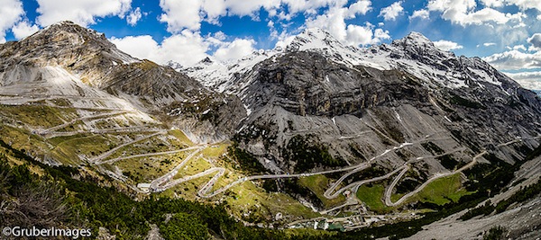
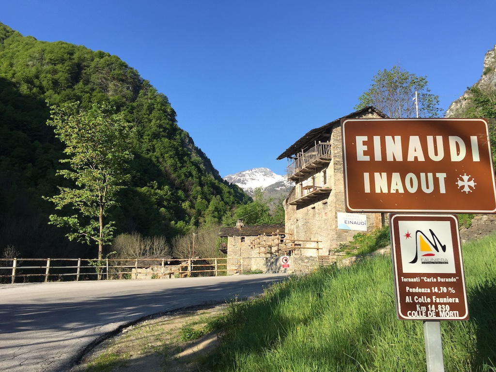
Where to start with Colle Fauniera? Well, it’s relatively unknown and I’ve seen it referred to as the “hardest climb you’ve never heard of” or something along those lines. It featured in a coffee table book which provided a lot of inspiration for this trip, Daniel Freibe’s “Mountain High”. The blurb sounded good and it was in the right area to fit into the road trip, so I put it on the list.

Having done the hard part of Ventoux, I really wasn’t looking forward to this after all. Part of me was as it’s quite a picturesque climb and it was the first high climb info the tip, topping out at 2511m. However, the bit in the middle note of 10% gradient wasn’t doing to be fun at all. At my weight and power, once the gradient hits 10% it’s proper hard work, even with easy gears.

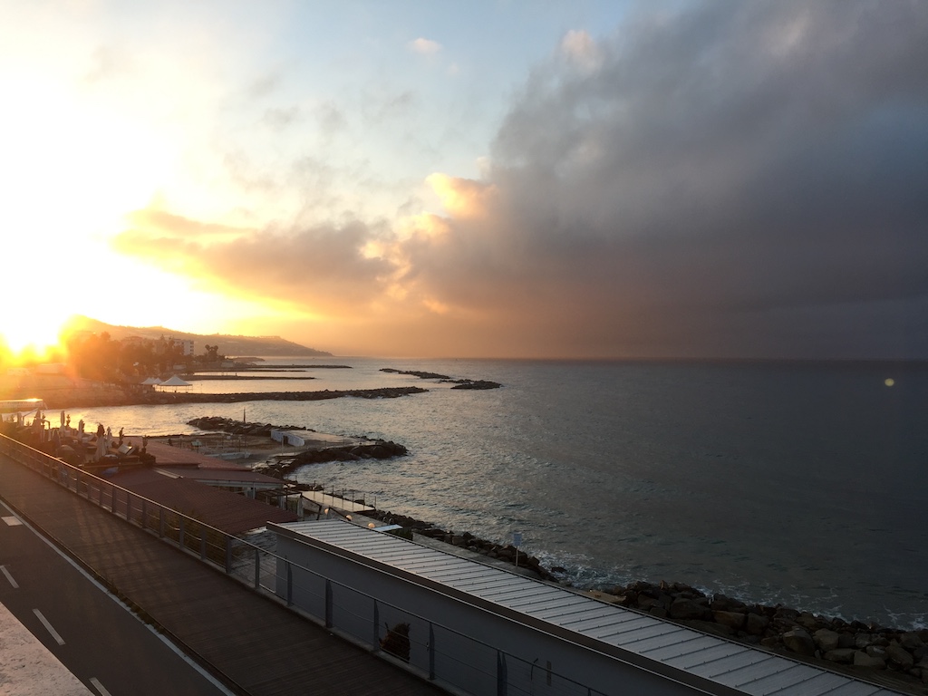
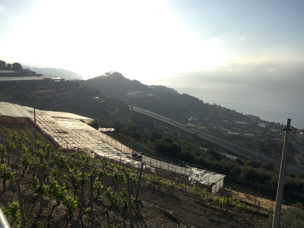
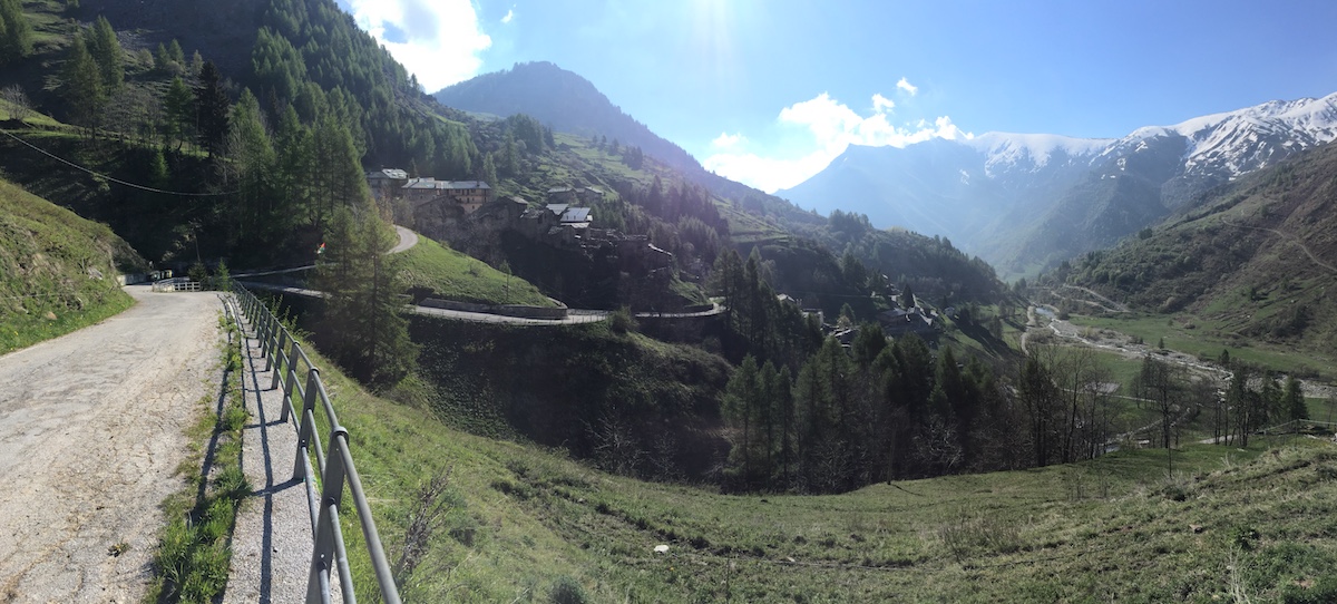
My original plan had been to ride up and over the top, then back down the valley on the other side, however that ‘valley on the other side’ was the one I drove in on the day before and it’s a heavily-trafficked route over from France with plenty of trucks, so I decided to skip that idea. With an early checkout the next day, I opted to drive to Pradlèves and just ride the climb. Wise decision.

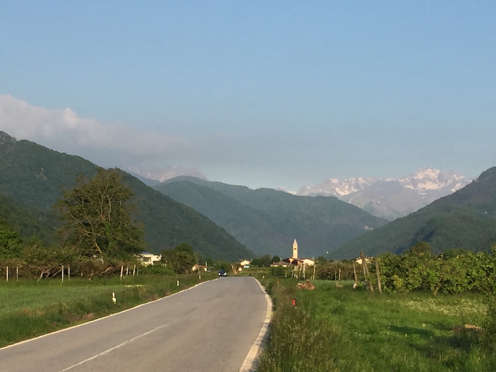
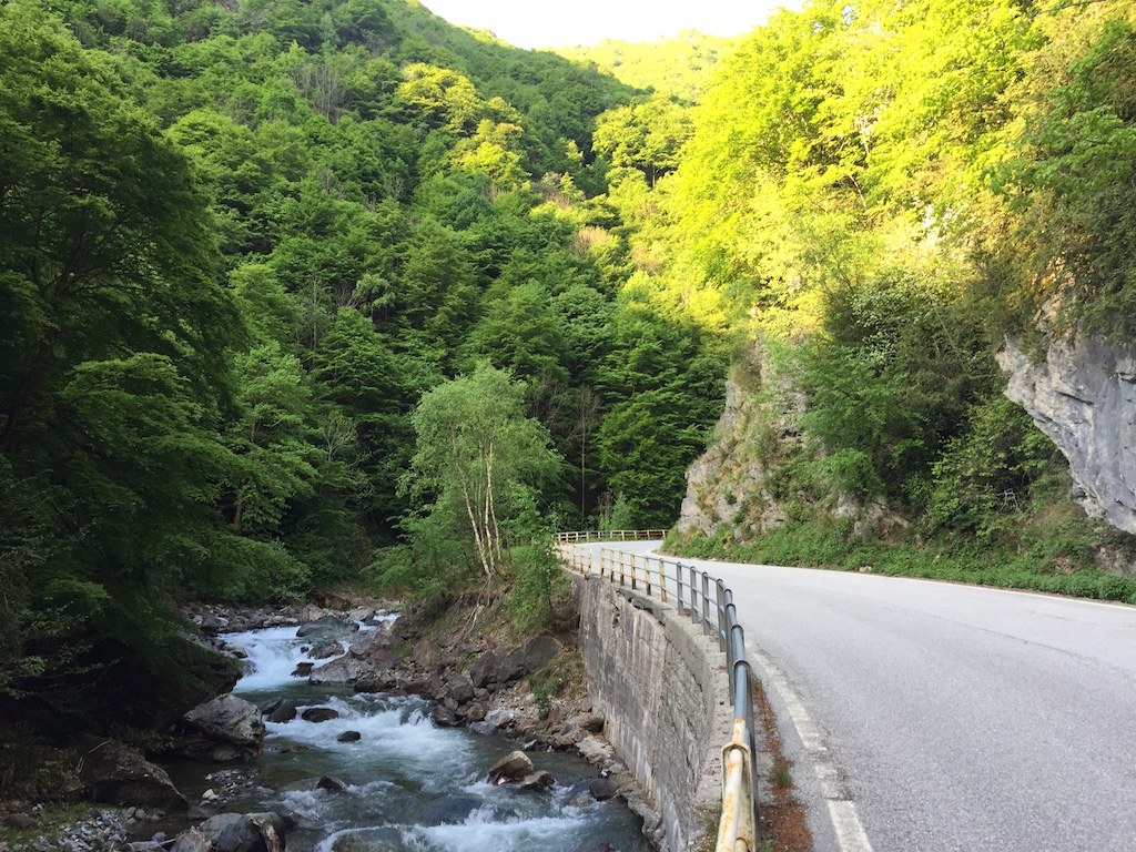
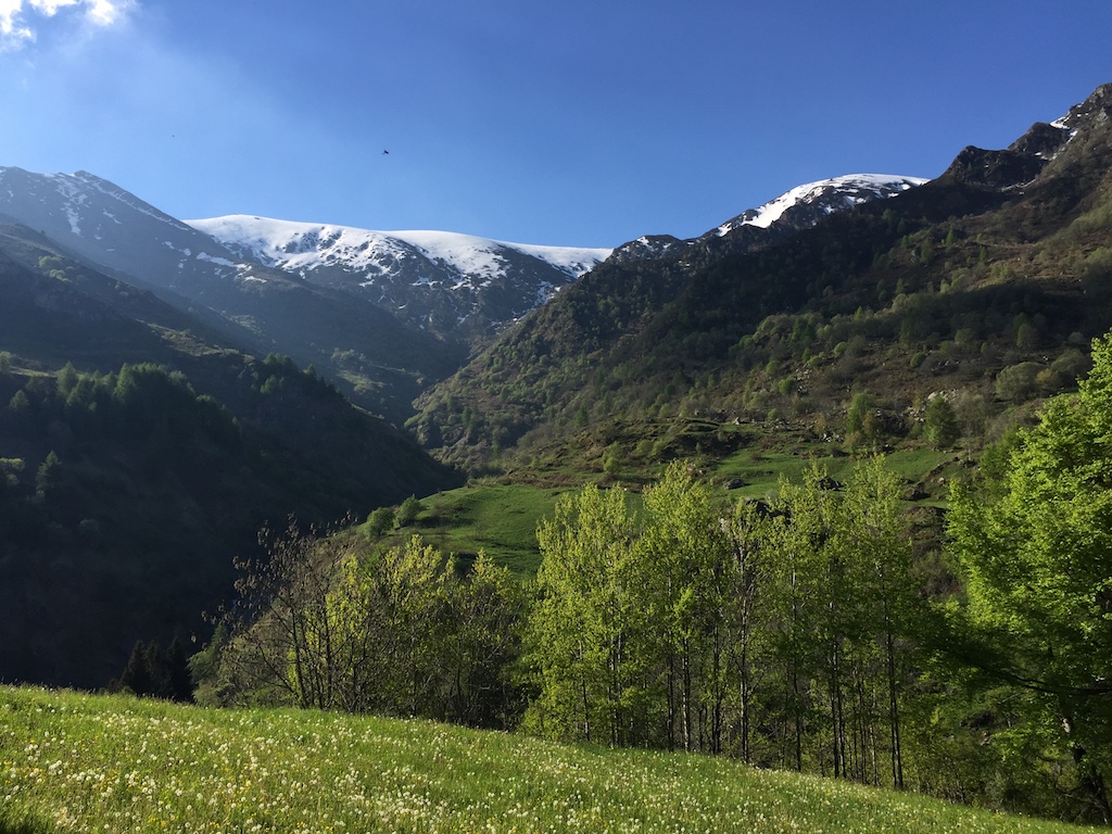
The early morning start had me on the bike at 7:40 and the valley road was quiet and still. The first part of the climb is not that hard and it meanders through a nice gorge, reminiscent of Col de la Cayolle near Barcelonette. The gradient is nice, the stream is burbling and all is right with the world.

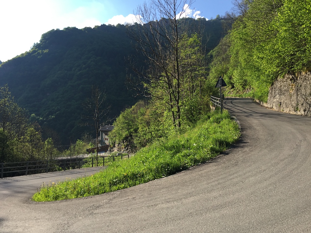
However, the fun has to end some time and there’s always some hard work to be done on these climbs. The beautiful views have to be earned. The gradient starts rising and at every turn there’s a little sign telling you what the gradient is. I was getting confused as I assumed that, like France, they were telling you what the average gradient for the next kilometre was, and quite frankly they were starting to scare me with gradients like 14% and 15%. I finally figured out it was only the gradient of the corner in question.

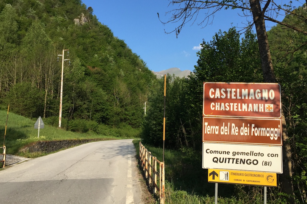
Once I got to the village of Campomolino the really hard part started. Minimum 9% for the following 6.5km with regular stretches over 10% and a final kilo to the Santuario San Magno over 11%. By this time I was starting to appreciate the alternative name for the climb, Colle dei Morti, the Pass of the Dead, and the regular shrines featured along the route. My legs were certainly dead by this stage.

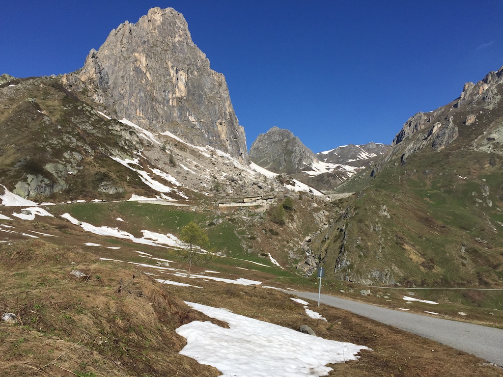
After the Santuario the gradient backed off and the road narrowed significantly. It seems that part of the Italian Army’s Alpine troops are stationed around there, so that’s the last “civilised” place that warrants a proper road. The remainder was old, narrow and a bit sketchier with gravel and mini rockfalls in places.

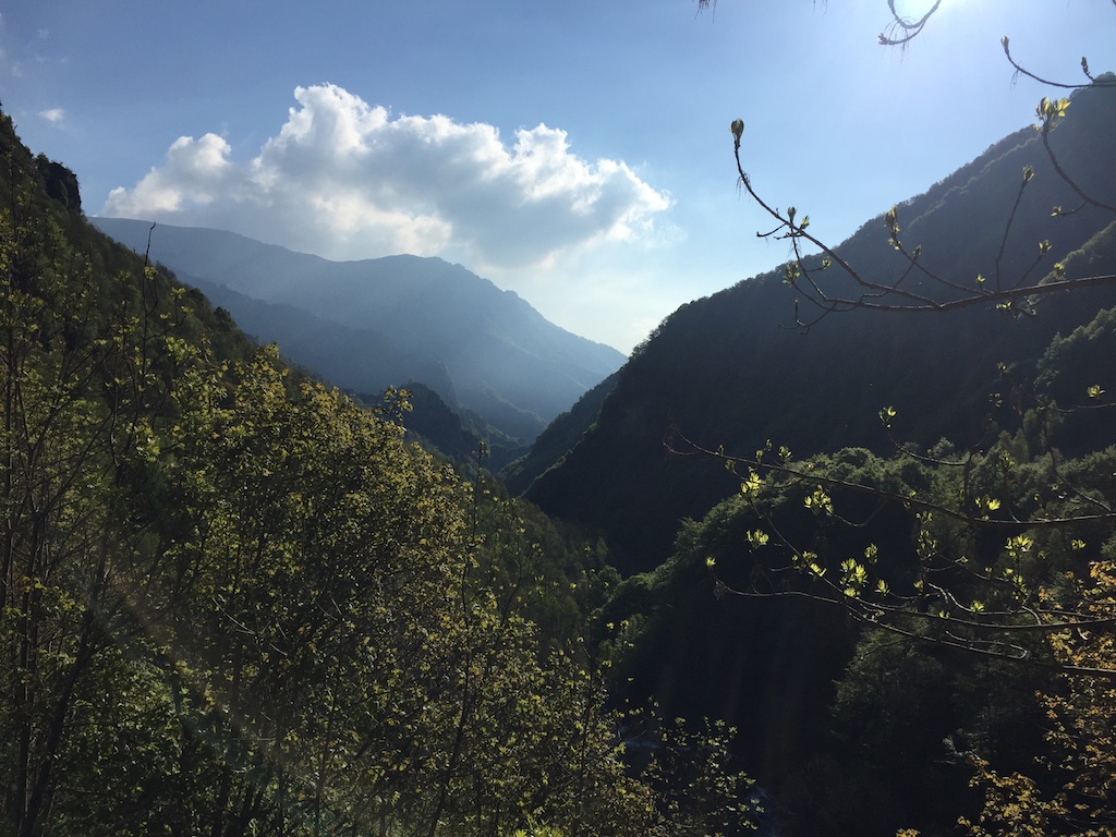
I was now past the tree line riding along a cliff-side track and heading towards a more exposed Alpine meadow. I could see a car parked up ahead which seemed a bit odd as it was the middle of nowhere. However, as I got closer the reason was revealed - no more road. Clearly the Fauniera isn’t an important pass, so no-one clears the road and from here on up the snow hadn’t really melted.

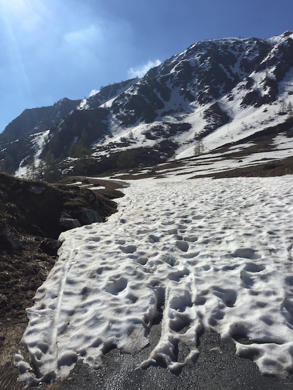
I hiked around the first blockage, rode a bit, hiked around another, rode a bit, rode around a final blockage before deciding to call it a day. I could see three more blockages in the next 600m, two of which you couldn’t walk around as they went right up to the edge of the slope and I didn’t really fancy hiking through snow in cycling shoes. Plus, with another 500 vertical meters to climb the snow was almost certain to get worse.

Still, the view from where I turned around was pretty good. The descent wasn’t that great, given that the first section was a goat track with a loose surface, and the second part was bloody steep with sheer drop offs so I’d no intention of letting the bike run. Down at the bottom there was jus time to throw the bike in the car and get back to the B&B for a shower before checkout time. Onwards to Susa!

Cipressa e Poggio

Milano-Sanremo, first held in 1907, is one of the oldest bike races in the world and, at 298km, is also the longest race on the World Tour. It is one of the five Monuments, the group of the most famous one-day races on the calendar, and it’s the first one to be run every season, hence its alternate name “La Primavera”. The race is largely flat but it’s the distance that takes its toll, so the question becomes who has anything left in the legs when the final climbs come in the run in to Sanremo.

I had intended riding Col de la Madone yesterday but a comedy of errors meant it never happened. Driving down from Milan, I chose to take the coastal route as followed by the race which of course was subject to local afternoon traffic. I ended up arriving later than intended so, after checking in & grabbing a bite to eat I opted to drive to Menton and just ride Col de la Madone from there. However, my newly acquired Italian SIM stopped working as soon as I crossed the border into France, so that meant no more maps or net or phone connection.

Rather than relying on my French to try to get directions back to Italy (easy outside a town, but pain in the arse in a town, with one-way streets and circuitous routes everywhere) I decided to turn around while I could still retrace my steps and call it a day. I managed to find a shop still open and load some credit onto my SIM so that the SmartPassport feature would work the next day for the drive to Bédoin.

Today it was up at dawn (jet-lag helped) and time to ride the last 20km of Milano-Sanremo.

Neither the Cipressa or the Poggio are mountains. They’re barely even hills and they’re both the sort of climbs that you could find around Sydney. However, as the last two climbs in Milano-Sanremo they are steeped in cycling history and a perfect wake-up for the legs after the flight from Oz.

There’s a nice bike path along the coast from Sanremo to San Lorenzo al Mare which is also famous, having featured as the Grande Partenza, or first stage, of the 2015 Giro d’Italia, used as part of a team time-trial route, so it was cycling history right from the start of the ride. The weather was perfect - slightly chilly, but early-morning sun gradually warming things up and it was a flat 20km out to the turnaround, at which point the real fun started.

First climb up was la Cipressa, 5.6km at 4%. Typically, in MSR, la Cipressa is ridden hard to stress the sprinters, but there’s never any real attacks. I cruised up it, soaking it all in. Unlike Newtown where you’re likely to have some graffiti art on your house wall, here instead there’s plenty of paint left by fans exhorting their heroes to greatness. Most of it seemed to be directed at John Degenkolb, the 2015 winner, along with some Italians like Bonifazio.

The descent off the Cipressa was great fun. The roads are in great condition and there wasn’t much traffic, though I still had to be a bit cautious as I didn’t know the road at all.

After a few km of flat road along the coast, it was time for the Poggio (3.6km @ 4%). This is raced full blast and an attack usually goes about 1km from the top. The descent is tricky and, since the bottom is only a few km from the finish, it’s possible for good descenders to hold their advantage to the line. For me it was a nice cruise, though I did find myself putting in a bit more effort than I’d intended, caught up in the history no doubt.

It’s quite an odd feeling knowing you’re riding one of the most famous climbs in all of cycling, while at the same time watching all these small-lot farmers getting their day started. My only previous experience of il Poggio was seeing the race live on TV, with the road closed and lined with fans. Riding up it sharing the road with locals in their micro-vans is a little different.

At the top there’s a sharp left turn and the descent begins. In real life, it’s a much wider T-junction and I had to wait for a white Audi to pass before I could get going. The advantage was that I then had something to chase down the descent. I was quicker through the bends, but he could obviously out-accelerate me on the straights. I managed to catch him two-thirds of the way down as a series of tight bends took their toll, but he was able to get away from me again on the following straight. Great fun though without needing to be reckless.

The descent over with, it was a sedate ride to the finish line as local traffic on the main road meant it wasn’t worth the risk trying to “race” to the finish.

Highly recommended if you’re in the area.

PS: I have descent videos, but they’ll have to wait until I have a decent net connection. I’m not sure uploading almost a GB from a rural Italian B&B would be appreciated.

Passo di Gavia

Day Two in Italy saw me riding Passo di Gavia, another famous climb from the Giro d’Italia, most notably Andy Hampsten’s ride in 1988 when he rode through a snowstorm to win the stage. Unlike ‘88, for me it was a beautiful, sunny day and, more importantly, the first few kilometers were an easy grade, giving ample time to ease into the climb.

Or so it seemed on paper! Prior to riding a climb I’d jump on Map My Ride, map the route and look at the elevation profile to give me an approximate of what to expect. However, on the longer climbs such as the Gavia (25km), the profile resolution isn’t great so there’s often some surprises. This was one of those times and I was struggling a little after a few kilometers on a pitch that was steeper than expected. Nothing serious, but 8% instead of 5% is enough to make you feel sluggish at the start of the day. The legs soon remembered what was expected of them and then the gradient eased up into Santa Caterina di Valfurva.

On the way out of town the ‘proper’ climb started with a few switchbacks and the road settled into a fairly typical 7-8% gradient. Whilst taking a photo I was passed, slowly, by a council truck who needed to do a three point turn to get around each hairpin bend, and I could hear his reversing beep for quite some time as he navigated the bends ahead of me, just out of reach. The Gavia is nowhere near as popular as the Stelvio, either with cyclists or motorcyclists and it was a quiet ride to the top passing only a few MTBers and a couple of runners on the way.

The top section is a relatively flat plain which just goes on and on before you reach the proper summit at 2652m in altitude. The ride plan foe the day called for doing both sides of the climb, so, after a leisurely refuel outside the café at the top I donned the windjacket for a fast and furious descent to the valley below.

Sixteen kilometres later it was time to turn around and head back up. This was always going to be a tough day and it wasn’t long before I was really struggling, facing a gradient of 16%. French road builders tend to plan things so that the gradient rarely goes over 12% but the Italians show no such restraint, with climbs like the mighty Zoncolan having sections over 20%. At 85kg I’m no climber and, even with my 32-tooth cog on the rear, once the gradient gets above 12% I’m quickly into the red zone. I’d noticed two signs on the way down, first for a 14% section and then the 16% one, so I knew what to expect in reverse. That didn’t make it any easier, though the spectacular scenery takes your mind off it, as do the narrow roads with barely room for a car and a bike side-by-side.

I have a power meter on my bike which tells me how much power I’m putting into the pedals. My average effort on medium grades is around 250W, and with a cyclist only being 23% efficient or so, this means that my body is actually generating over 1000W in order to put 250W into the pedals. The surplus is converted to heat which I then have to lose to prevent overheating, a task made more difficult as the mercury rises. With the temperatures now over 30C and the roads now above the tree line, I was keeping an eye out for suitable places to get a bit of shade for a quick opportunity to cool down.

I’d been on the road for over 4 hours by this stage and the combination of fatigue and heat was starting to get on my nerves. My legs were feeling tired but still able to plod along, tapping away at the pedals and I wasn’t particularly exhausted. However, my head was just not in the game anymore and I was desperate to get the climb over and done with. There’s a tunnel with about 3km or so to go to the top and I’d been hoping to see it around every bend for what seemed like ages, as it promised some cool respite from the beating sun, yet, every time I turned a corner it wasn’t there, until, finally, there it was. I took a five minute breather, downed a gel, switched on my rear flashing light and then rode the few hundred metres savouring the darkness and the cool temperatures, until, emerging at the other end I was greeted by the sight of the final few switchbacks to the top.

Still, although the end was in sight, it wasn’t easy, with the gradient now ramping up to 10% and at one stage I looked down and I was pushing out 350W and only going 7.5km/h! The metres pass slowly at that sort of speed and the fact that the altitude was creeping over 2500m didn’t make things any easier either. Thankfully, after another photo stop (really an excuse for a break) or two, the gradient finally eased and I could see the small lake just below the summit. Another two small bends and I was on the final approach which, although it was still 4% or so, seemed flat after 16km of climbing.

Check out that face! So knackered I can’t even be bothered smiling now that all the climbing is over and I have a 26km descent to enjoy! After some more food and some relaxing time in the sun, the windjacket went on and all was right with the world as the descent began. I managed to pass two cars, a truck and even two motorbikes, though in fairness the guy was riding slow waiting for his better half. Still, it’s fun to see a bit of clear road and out-brake a moto into a bend :-)

The Strava stats show 84.7km with an altitude gain of 2,700m and 3,700 calories burned. Only managed 66.4km/k on the descent though.

All photos

Passo dello Stelvio

So, time for a bit of a trip report. Today was my first day of climbing in Italy and my first proper mountain climb in tow years. And what a climb - the Stelvio Pass! Finish of the Queen stage of this year’s Giro d’Italia, one of the most iconic of bike climbs, plus one of Top Gear’s Greatest Driving Roads and 21.5km, 1560m vertical gain at an average of 7.3%, with 39 switchbacks. That’s some way to wake up the legs!

There was no easy way to ride this. The road starts rising right from the front of my hotel so there’s little opportunity to easy into it. After little over a kilometre through the village of Bormio I’m on to the climb proper, down to the granny ring and into a two hour climb. With La Marmotte in less than two weeks this will hopefully give me an indication on whether the interrupted training over the last few months is enough.

Things feel pretty tough at the start which starts the doubts forming, but I choose to ignore them as it will take a while for my legs to adjust from flatland. After a few kilometres I round a corner and see the road snaking off into the distance along the side of the mountain and just keep plugging away, remembering to switch on my rear blinker before entering the handful of tunnels along the way.


Once out of the last tunnel I can see the first batch of switchbacks. I’m really struggling now and starting to worry that my training has been useless when I see “14%” painted on the road and I relax. 14% is always going to hurt a lot! I stop to catch my breath after that section and to snap some photos before resuming my climb.


Looking down on a set of switchbacks is one of the iconic cycling mountain views and certainly a lot more enjoyable than looking up at them, coupled with the satisfaction of having already ridden them and the knowledge that later you’ll get to descend through them as well. The gradient eases up now as the road meanders through a high-altitude wide valley before pitching up again for the final batch of hairpins en route to the summit. There’s clearly a classic car rally on and lots of nice old cars drive past, including a nice Ferrari and some open-topped 1930s marques I don’t recognise. There’s also regular groups of motorcyclists enjoying the ride as well.

I really start noticing the altitude above 2400m and there’s still 360m of vertical gain to go, but the last pitch isn’t too bad, the goal is in sight and it’s just a matter of plugging away, getting ever closer until finally that’s it and you’re greeted by tacky souvenir stands and a profusion of bratwurst vendors. 2759m high!!


My original plan was to descend the 24km to Prato on the other side, turn around and ride back up, but I figure that this is too much for my first day in the mountain. However, the Prato side provides probably the iconic Stelvio photo so I decide to descend the first 7km before turning to I can at least say I’ve ridden the famous switchbacks.


The road surface at the top isn’t great, so I’m a bit cautious braking into the first few bends, but I’m able to open up a bit more as the road improves and I reacquaint myself with big mountain descending. It’s over all to quickly though and it’s time to turn around and ride back up. I find riding up switchbacks quite enjoyable as, although it’s usually hard work, I can focus on just getting to the next bend which isn’t usually that far away. Stopping for photos is also a good excuse for a quick breather! A bit under an hour later I’m back up at the top and it’s all downhill from there back to the hotel.

After donning my windjacket to protect against the cold, it’s time to enjoy the payoff from all the hard work lugging my arse up the mountain. Since there’s not much traffic coming up the mountain it’s possible to use most of the road and, as I get more comfortable, I brake later and later and optimise my corner exit to keep my speed up. The wide valley which provided welcome easy gradients on the way up is now a hinderance on the way down and I have to pedal to keep my speed over 45km/h which is a bit annoying.

Hot air rising from the valley below means a welcome tailwind on ascents but an unwelcome headwind on descents and as if that wasn’t enough I manage to drop my chain. Looking down to see what’s going on is precarious at speed with lots of bends, so I pull over, sort out the chain and take the opportunity to remove my wind jacket now that I’ve lost some altitude and the temperature has risen. After that it’s back to fast descending with the final part of the descent particularly enjoyable with some nice linked turns through the trees. In no time I’m back in Bormio and the first day in the mountains is done and dusted.

After uploading to Strava I see that while I was ranked 158th on the way up I was ranked 14th on the way down, despite my chain related stop. Without that I’d have been 7th! Damn, so close! Top speed 72.2km/h.

All photos

June 27th

This is going to be my first ride when I get to Italy. The Passo della Stelvio, as seen on Stage 20 of the Giro d’Italia. Look stunning!

Check out the more Stelvio photos at Jered Gruber’s Flickr page.