Mont Ventoux

Mont Ventoux, also known as le Géant du Provence, the Giant of Provence, is one of the most famous Tour de France climbs and has been on my to-do list for a while. Given that May is still quite early for some mountain passes to be open, detouring to France to ride Ventoux made perfect sense as it’s both far enough South and low enough to be clear at this time of year.

There are three ways to the top; two hard ones and an easier one, with the one starting in Bédoin the hardest and ‘official’ Ventoux climb. If you’re only going to ride one side, then the Bédoin side is the one to do. However, there’s a club called les Cinglés du Mont Ventoux, loosely translated as The Mont Ventoux Nutters, to which you gain access by riding all three sides in one day. I figured I’d give it a go, so I sent off my €20 and they sent me a brevet card which needed to be stamped at the bottom and top of each climb.

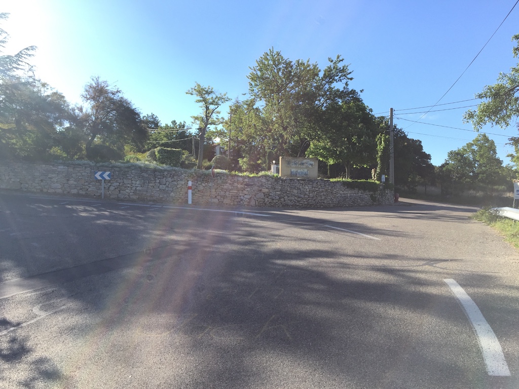
The recommended route is to start in Bédoin to get the hardest climb out of the way first (21.5km @ 7.6%), then descend to Malucène to climb from there (21km @ 7.3%), leaving the easiest climb from Sault until last (24km @ 5.1%). So, with a hearty breakfast sitting in my belly, I descended the 4km back into Bédoin, got my card stamped, turned around and got the day started.

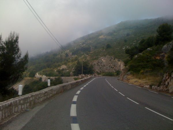
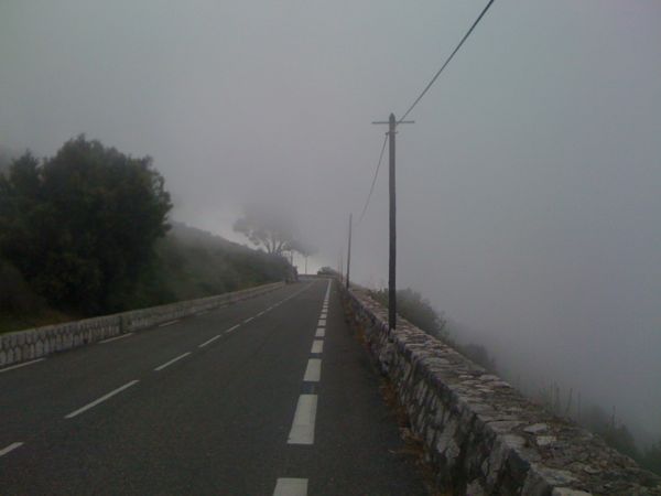
The first few kilometres are comfortable enough and there’s ample time to admire the scenery, but once you get to the St. Estève bend the gloves are off and you have to knuckle down to some hard work. The next 10km to Chalet Reynard averages 9% and there’s nothing you can do except grind it out. Even with the easiest ‘normal’ gears you can get on a road bike, 34x32, it still took me an hour to ride that section at an average heart rate of 161 (max. is 190).

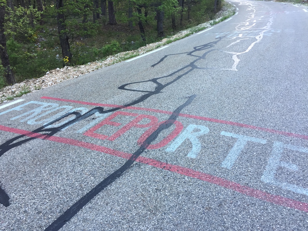
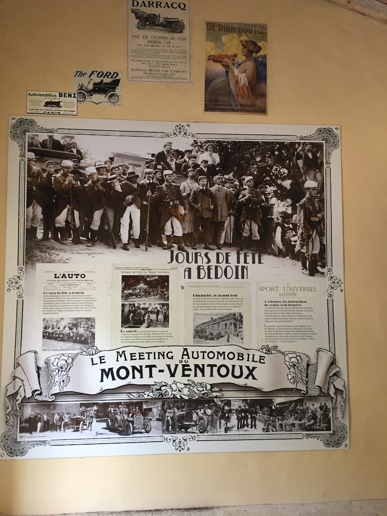
The gradient never lets up, so there’s no easy sections to get your breath back. However, there’s plenty of graffiti left over from the various times that the Tour de France has passed this way, including one of Marco Pantani, who last rode Ventoux in 2000. I suspect it was painted in recent years rather than lasting from 2000 though! Shortly before Chalet Reynard there’s also a small hut with various items dedicated to early car races on Mont Ventoux - it was famous before cycling too!

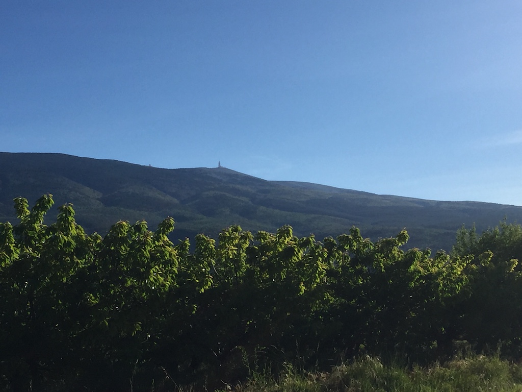
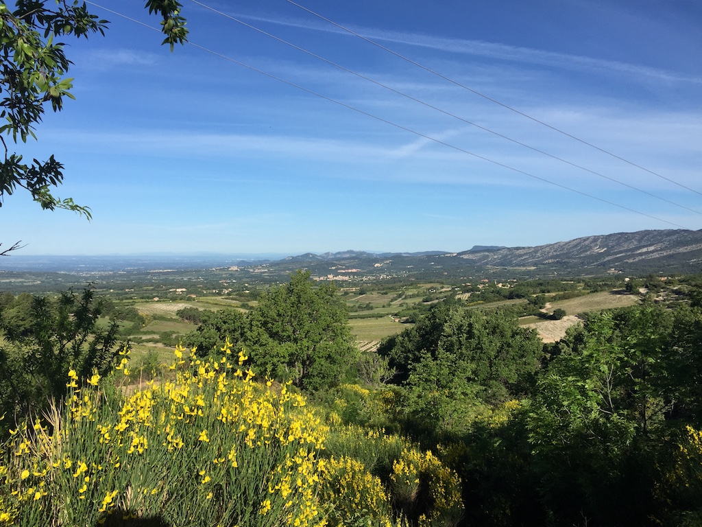
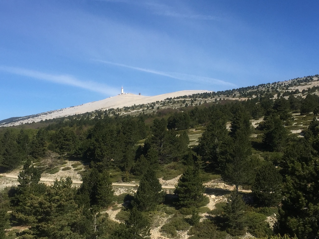
The weather station at the top of the mountain is the beacon letting you know exactly how far you still have to go. The hard part is through the forested lower slopes so you rarely see the top, but, as you approach Chalet Reynard, the trees start to open up and you can start seeing the progress you’ve made.

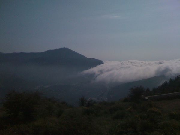
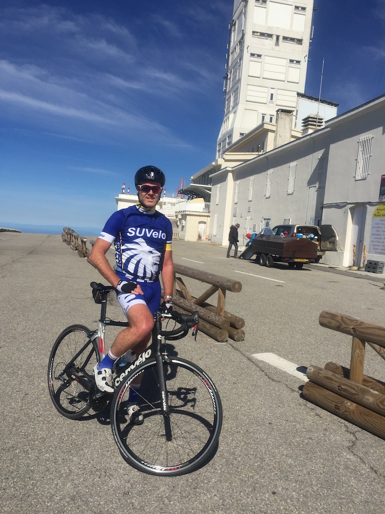
I took a breather at Chalet Reynard and refilled my water bottle before continuing on. The gradient eases back a bit from here to the top to ‘only’ 8%, but it was partially replaced by a bit of wind. Mont Ventoux is known for some ridiculous winds, with last year’s stage of the Tour needing to be shortened as there were 100km/h+ winds blasting across the exposed top. It wasn’t that bad for me though and after some more plodding I finally made the top. Success!

The downside to reaching the top was seeing that there was a barrier across the descent to Malucène, with a digger and various trucks working nearby. I approached one of the workers to see if the road was closed and he said yes. I asked “even for bicycles” as often workers are quite happy to let bikes through, but today it was not to be. Road closed for everyone.

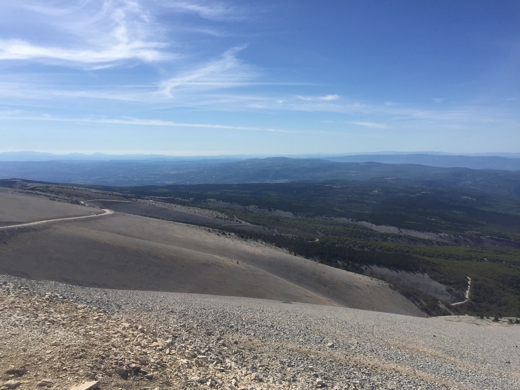
That was a bit of a pain in the arse as it meant the attempt at three-in-one-day was over and done before it got going. I got my card stamped at the top anyway and figured I may as well do the Sault climb too. The top section of the descent wasn’t as much fun as I’d anticipated. I find I usually take a day or two on these trips to get my eye in and get comfortable reading turns so I was a bit cautious as this was my first proper descent and the sudden wind gusts made things a bit unpredictable. After Chalet Reynard I was back in the shelter of the trees, and, apart from a relatively flat bit at the top, I could concentrate on my line for the remaining 15km.

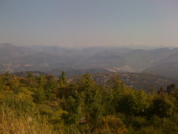
I stopped for a coffee in Sault, sitting out on the terrace of a bar from which I could see the top of Ventoux in the distance. A bit daunting seeing it so far away and realising I’ve got it all to do again. Leaving Sault, there’s a brief descent, followed by a brief bit of harder climbing before the road settles down to its easier gradient and I could look around at the rolling countryside dotted with lavender farms. It’s quite picturesque. The road meanders around various outcrops at a reasonably steady gradient, never gaining massive amounts of vertical but also never slack enough that you get up a decent amount of speed.

By this stage I was getting a bit over it. It wasn’t that it was too physically demanding, more that my heart wasn’t really in it now that the main goal was scuppered. Once the climb from Sault reaches Chalet Reynard it’s the same route to the top from there as I’d already ridden from Bédoin, so I decided I wouldn’t bother with that again and would descend straight from Chalet Reynard. Shortly after making this decision the gradient eased and it was at last possible to keep the pace up all the way to CR.

I had a quick Coke in the sun and then switched on the GoPro for the fun descent back to the B&B. At 9% nearly the whole way it promised to be reasonably quick, even if I didn’t know the route so would have to be a bit cautious into the bends. The top half was great fun, but then I started catching a VW and ended up stuck behind him for the second half. The popularity of the climb meant that there was a steady stream of cyclists coming up the other way, plus fairly regular cars, so I wasn’t comfortable trying to go around him. Thankfully he seemed up for it and kept up a reasonably quick pace so it wasn’t ridiculously slow. 1h10 to climb up, just under 12mins to get back down. Good fun!

La Marmotte

I was pretty tired after the last 10 days of climbing, and Alpe d’Huez had been bloody hard work on Wednesday, so I was worried that maybe I’d overdone things in the run up to the big day. I did nothing on Thursday and then on Friday I went for a 40min cruise along the valley floor followed by a dip in the local swimming pool featuring some spectacular views from the water. Friday evening was spent giving the bike the once over, fitting my transponder and race number and making sure I had all my gels/powders packed and ready to go for the morning.

The alarm went at 5.30 and it was followed by a quick shower, down to breakfast and an attempt to force-feed myself in preparation for a big day. Pre-race nerves (in a good way) usually mean that I have bugger all appetite in the morning, but I knew it was important that I load up for the day ahead as I’d never be able to eat enough along the route to keep up with energy demands. Once that chore was complete I threw the bike in the back of the car and drove down to the main road. There was no way I would be able to ride the 10km climb back to the guest house at the end of the day!!

With 7,000 participants or so, start times are staggered with the first group off at 7, the second at 7.30 and the final group at 8. Out of the guys in the house, Dan & Simon were in the first group, Giles the second and myself and the Irish lads were in the final group. Hugh and Joe were aiming to crack eight hours which was way too fast for me, but Conor and Cormac had been climbing at my pace up Col du Glandon so we’d probably end up together. We joined the back of the 8am start queue and slowly shuffled forwards, crossing the start line at 8:11 with 174km ahead of us.

I’d worked out split goals based on the recon rides I’d done and had taped them to my bike’s stem. The descent off the Glandon was time neutralised as it’s considered too dangerous with so many riders still bunched together early in the event. Bearing this in mind, I’d structured things to aim for a finish time of 11hrs, which, when the descent was subtracted, should mean I’d attain the silver medal goal time of 10h20 for my age group. That was all ahead of me as I left Bourg, hitching on to a line of Dutch guys flying towards Allemond. I may have been taking it easy, but I figured I might as well take a tow if one was being offered. After the quick zig-zag up the Barrage there were a couple of flat kilometres and then we were into the first climb of the day, Col du Glandon (profile). I could see Conor and Cormac a bit below me as they hadn’t jumped a Dutch train, but I figured they’d catch me on the climb so I kept going at a nice comfortable pace, keeping the legs spinning over and using the power meter to pace myself. Having ridden the climb a days ago was a big help, as I knew where the tough bits were and could adjust accordingly. Also, it wasn’t raining like it had been on Monday which was a big help, as was the fact that there were so many other cyclists around. As a result I made it to the top with 2h20 on the clock, almost 25 minutes ahead of schedule and I’d been riding easier than on Monday.

Wary of going out too hard, I opted to take my time at the food station on top. The French know how to do race food and there were baguettes, salami, brie, fruit (fresh & dried) and jellies on offer. I spent 10 minutes eating a bit of everything and refilling water bottles before hitting the descent. Although it was neutralised I pushed it a little bit, simply because it was fun and there weren’t many people around me so it wasn’t crowded and I could choose my line. It was still a bit sobering to come across an ambulance blocking the road where an unknown rider had obviously come a cropper, and we had to carry our bikes through a field to get by. Once the descent was over I faced a 20km run to the base of the next climb at St. Michel de Maurienne. It’s a false flat, very slightly uphill, so the recommendation had been to get into a group and get a tow rather than slogging it out on your own. A few hard efforts saw a few of us latch on to a peloton in front and I just tagged along for the ride from then on. I’d been on the road for more than three hours at this stage and was feeling good, though the combined might of the Telegraphe & Galibier was on the horizon so it was a case of drinking regularly and saving the legs as much as possible.

As we arrived in St. Michel de Maurienne I stopped for a water bottle refill and checked my times. Bang on four hours meant I was still 30 minutes ahead of schedule, despite dawdling at the top of Glandon so I was pretty happy starting the Col du Télégraphe (profile). Again, the recon rides were invaluable as I knew this was a fairly easy climb with a predicable gradient so I settled down to a comfortable rhythm, kept sipping away at my drinks and kept on keeping on. I still prefer to ride a while, stop for a quick stretch and repeat, rather than riding non-stop, so I was slowly passing the same people over and over again. Nevertheless I was still feeling good and climbed the Télégraphe in 1:08, the same time I’d taken on my recon ride. It had taken me 3h50m to climb the combined Télégraphe/Galibier on Tuesday, including a 20m stop at the top of the Télégraphe and a 30m coffee stop at Plan Lachat, so I’d allowed myself 3h30m for the combined climb during the Marmotte, resolving that I wouldn’t be having any lazy stops en route.

After a coke and a stretch I headed off on the short downhill to Valloire, followed by the short climb to the second refuelling stop of the day. I was still facing 15km to the top of the Galibier (profile), so this was another leisurely stop, making sure I ate enough, though time got away from me a bit and I ended up arsing around for ten minutes, slightly longer than planned. The next target was the coffee shop at Plan Lachat which was reached after 40mins of solid climbing, at which point I sat on my arse for another 9 minutes, psyching myself up for the tough final 8km to the top. I was starting to get a little tired by this stage. Nothing serious, but I was looking forward to the summit as I knew there was more than an hour of descending after that before tackling the Alpe. I was also a bit apprehensive about the super steep section from the tunnel to the summit - it was tough enough on the recon ride without starting it with 100km+ and nearly 4000m already in my legs! There was amply opportunity for it to play on my mind as I approached it at a glacial pace, but, once there it wasn’t as bad as expected. In fact, it seemed easier than on the recon ride, probably because I’d been building it up too much over the previous half an hour. The summit loomed and I was greeted by an unexpected food stop. My bike computer read 7h30, so I was still half an hour ahead of schedule, giving me ample time if it all went to shit on the Alpe.

More food, this time with second helpings as I had over an hour to digest on the descent back to Bourg. The first part of the descent is steep and a bit narrow until you get to Col du Lauteret, after which it’s main road all the way back to Bourg. The roads weren’t’ closed to traffic, but all the cars were well aware that bikes (lots of them) were around and we pretty much were given priority. Frence drivers are generally awesome around bikes and don’t mind waiting behind you until it’s safe to pass, but with me hitting speeds up to 70km/h I didn’t have to worry about holding cars up. I did have to hold myself back a bit though, as I found myself powering out of turns and figured I’d be better off saving my legs for the final climb up Alpe d’Huez (profile).

I reached the final food stop at the base of the Alpe in 8:51, almost 40 minutes ahead of schedule and was still feeling reasonably good. I had a quick stop for a handful of jellies, refilled my water bottles and got going. No time to dawdle with the Alpe ahead of me as I knew that there was no respite from here to the finish line. The first two kilometres are over 10%, then it settles down to average around 8% for the rest of the climb, so if things went bad and the day caught up with me, I could lose serious time struggling to the finish. From doing the recon ride I knew where the water stops were and knew roughly the sections where the gradient would ease for a few hundred metres, so I had a few targets in mind. First of those was to get the 10%+ section out of the way at the start. I’d climbed it at just under 290W on Wednesday, which was a bit too hard so I deliberately stayed well under that. I’d built some leeway into my schedule precisely so I’d have time up my sleeve for the Alpe, so it made sense to use some of it and the steeps felt a lot easier.

There are 21 hairpins on the way to the top, numbered in descending order, each signposted with the names of previous winners of Tour de France ascents of the Alpe and the water fountain outside the church at turn 16 signified that goal No.1 was complete; the 10% gradients were over and done with and I could now just settle into my normal climbing rhythm and hope it would get me to the finish. I was still stopping every 2km or so for a quick stretch, and mainly passing people rather than being passed which is always a good feeling. By the time I made it to the second church at bend 7 (Goal No.2) I was starting to feel the days exertions. I wasn’t so much tired as just over cycling. My arse was sore from so long in the saddle, my shoulders were stiff & tight and my knee and hamstrings were starting to stiffen up as well. Apart from all that, my legs still felt OK whilst actually cycling, so there was no fear of stopping, but my quick stretch stops were no longer having an effect and I was just willing the finish nearer so I could get off the bloody bike! Still, it was just mind games and minor niggles rather than exhaustion, so I kept plodding away until I finally crested the hump into the village where all the earlier finishers were sitting around, enjoying a beer and offering encouragement to those of us yet to do so. The village marks the end of the serious climbing, though there’s still a kilometre or so until the Marmotte finish, which feels flat, even though it’s between at 3 and 5%! Time to shift into bigger gears, get the speed up again, zip up the jersey and I crossed the finish line in 10:21:31, riding no-hands with a big smile on my face for the finish line photo, only later to discover that the bloody camera was quite a bit after the finish and it captured a more accurate portrayal of how I was feeling at the time :-)

That was it! I’d made it and was filled with a mixture of satisfaction at the accomplishment and relief that I could finally get off the bloody bike! After dropping back my timing chip I got a printed certificate with my official, adjusted time of 9:36:59, which was well inside the silver goal time for my age group, so I got to swap the €10 timing chip deposit for a nice silver medal. I also bought myself a souvenir bike jersey now that I’d finished, as I’m always reluctant to do so before completing an event, as there’s no point having a jersey or t-shirt for a event you didn’t complete. So, as the French say… FIN.

Stats:
10:21:31 total ride time
174.26km distance
4845m climbed
6062 calories burnt
69.9km/h top speed

Col du Télégraphe and Col du Galibier

My second ride in France saw me tackle the combined might of the Col du Télégraphe and the Col du Galibier. As the base of the Télégraphe is 90km from where I was staying, riding there was out of the question so myself and Jason drove to the top of Galibier, parked the car and got organised. Jason’s an Aussie guy staying in the same place as me, whose bike I recognised from seeing it outside Sutherland service station six months ago while I was on a Waterfall ride. It helps when your bike is a custom steel creation, handmade by Dario Pegoretti, one of the most famous bike builders around, with a one-off paint job. It stands out from the crowd, so I recognised it immediately when I saw it again hanging in the bike shed at our accommodation. Small world!

The ride started with a 35km descent to St. Michel de Maurienne which was great fun. Unfortunately they’d recently gravelled the bottom half of the Télégraphe so caution prevailed and the fun was over. After a plate of chips in a local restaurant it was time to turn around and ride the 35km uphill back to the car. From doing my research I knew that the Télégraphe was pretty civilised, at a fairly constant 7% gradient for 12km, then some downhill into Valloire before the Galibier itself started.

The kilometres ticked away, chatting to Jason about our various cycling experiences. He’s lighter and fitter than I am, but was also a bit wary of the climb so was happy enough to ride at my pace. The road is tree-lined the whole way up, so there’s no wide-ranging mountain vistas to take your mind off the climb and it’s just a question of putting the head down and slogging away at it. The gravel section was a pain in the arse as I could hear bits being picked up by my wheel and scraping through the small gap between tyre and the top of the forks. Maybe I would have been better off with the standard 23mm tyres instead of the 25mm ones I had? Unlike yesterday, the sun was out and it was nice and hot. No more rain to deal with. Also unlike yesterday, the Télégraphe has kilometre markers indicating both the average gradient and the distance remaining to the top where the Glandon doesn’t. This made it easy to gauge your effort and we were soon at the top, part one of the climb conquered.

I bumped into a guy, KKB, I knew from a triathlon forum I hang out on back in Oz who was over to do the Tour of Mont Blanc, a one-day, 330km ride with 8000m of climbing! He’d also been over two years previously to do Marmotte, though we hadn’t met then and he’d finished the event where I DNSed. Clearly Mont Blanc was the next step. Food for thought! He headed off up Galibier with his riding mates while we opted to grab a refreshing Coke and cool down a bit.

The ride resumed with a 5km descent into Valloire before the 18km of the Galibier started. Everyone says the Galibier is a beast of a climb, so I was a bit apprehensive starting out if I’m honest, and it seemed to ramp up straight out of town as a warning. Thankfully it didn’t last and relented to three or four percent for a few kilometres before returning to 7%. That was the easy bit out of the way and it was solid climbing along the valley from there on. The Tour de France had passed this way last year, so we passed plenty of graffiti painted on the road, encouraging various riders including this one for last year’s champion.

Shortly afterwards we reached Plan Lachat, 8km from the top. We’d been keeping an eye on the kilometre markers, which, along with the remaining distance, also indicate the current altitude. We know that Galibier tops out at 2645m, so some quick calculations showed that the remaining 8km was going to average close to 10%. By now it was getting bloody hot again, so we decided to stop for a quick rest and a refuel. We bumped into KKB and his mates again and ended up sitting there for half an hour chatting to various other cyclists, enjoying the sun and watching riders slowly zig-zag up the steep section ahead of us.

There was no point putting off the inevitable, so, while Jason went for a toilet break I took off since he’d quite happily outclimb me anyway. As it turned out, the gradient wasn’t that bad being only eight or nine percent, so I was able to plod along at a reasonably comfortable effort, stopping for the odd photo along the way.

One of the enjoyable aspects of proper climbing is the opportunity to look over the side and clearly see how much altitude you’ve gained in a relatively short space of time. The first few kilometres after Plan Lachat gave ample opportunity for this as they snaked their way up the side of the mountain. I could see Jason behind me, but didn’t appear to be gaining as quickly as I had thought he would. I passed a small shop advertising the local cheese and I wondered if they did much business at all. I couldn’t imaging anyone in my situation, slogging it up one of the Tour’s toughest climbs, stopping to buy cheese! The ride changed here, with the road now skirting along the side of a wide plain, though the gradient didn’t slack off at all. I knew the last two kilometres were the steepest and things were only going to get harder as the altitude continued to increase, so rounding a corner and finally being able to see the top wasn’t the joyous experience you’d expect.

Jason sailed past me at this stage with some Dutch rider in tow and there was no way I was going to ride at their pace so I left them to it. Not long afterwards I reached the tunnel, built so that car traffic doesn’t have to go over the top. For bikes, we skip the tunnel and turn left to be greeted by 12% gradients and some hard work to really earn the summit. By this stage it’s over 2500m and you can feel the altitude and, just to drive the point home, I ended up riding the last few hundred metres to the top through a cloud!

So, that’s three of the four Marmotte climbs out of the way. Only Alpe d’Huez left!

All Photos

Glandon and Croix de Fer

When I went to France two years ago for my first attempt at Marmotte, I’d buggered up my knee about six weeks before I left Australia. The first week of climbing went OK, but then I had three weeks off holidaying with Jacqui and attending Sean & Lisa’s wedding, then, when I resumed climbing, my knee gave out on the first, steep pitches of Col du Glandon. It was here, 15 minutes into the climb two years ago, that I finally decided to withdraw from Marmotte. Today was a big day as it would banish any lingering demons and disappointment from that day.

I’m staying up in Ornon with King of the Mountains (who I highly recommend) and have met a bunch of Irish guys from Kildare who are also here to do Marmotte. After farting around this morning waiting for everyone to build their bikes and replace the various bits and pieces they’d left at home, we all rolled out of Bourg just after lunch in the pouring rain. Big Joe and Hugh are the fit ones, so, once we’d passed Allemont and got onto the climb proper, they took off. Myself, Cormac and Conor were a similar pace, so we stuck together. They’d gain a few metres on me through the steep bits and I’d reel them back in once the gradient eased again.

The rain continued for a while before easing off. Cloud cover remained and temperatures stayed low which suited me just fine. After all the climbing in Italy, my legs were feeling good and the steep pitches which had stopped me in my tracks two years ago presented no problems this time. I spent most of this first part trying to figure out if I’d passed the point where I turned in 2010 but nothing obvious stood out and we soon reached Le Rivier d’Allemont which ended that train of thought. The ride profile indicated a short downhill after the village before climbing resumed but hadn’t mentioned the downhill gradient was 12%! Losing height mid-climb is always a pain in the arse and a steep gradient means a lot lost in a short space of time. All that effort wasted!

The first section of the climb out the other side was also steep at 11% for the first kilometre or so, before settling down to more manageable gradients. Towards the beginning of the climb we’d been passed by two trucks carrying full loads of live sheep, and, after climbing past a few more switchbacks, we were now greeted by those same sheep milling around the road, having presumably been dropped off in their summer paddocks. After a bit of messing around trying to manoeuvre through a herd which wasn’t sure which side of the road it wanted to be on, it was onward and upward towards the Lac de Grand Maison with the large dam wall initially greeting you before slowly revealing the lake itself.

At this point the view opens up (well it would have if it wasn’t so overcast and the clouds weren’t so low) and the road starts following the side of the valley at a consistent gradient instead of turning back on itself. There was another downhill section, though not as bad as the first, before the last pitch upwards to the Cols. Col du Glandon was the first to arrive, a short 200m detour to the left off the ‘main’ road. Cold and bleak, we didn’t linger long before getting back on the main climb for the few extra kilometres up to Col de la Croix de Fer. After the trophy photo we huddled into the café for a warm coffee before rugging up as best as possible for the cold, wet descent.


As we left the café the clouds closed in again, reducing visibility to less than 20 metres - not really what you want when trying to descend off an unfamiliar mountain on wet roads. We were soaked through as well, a combination of rain and sweat, so the first few kilometres were bloody freezing until we’d descended out of the clouds and the temperatures rose just a little. After that the descent was more fun, though what was a 12% downhill on the way up the mountain was now a 12% uphill into Le Rivier d’Allemont. I could have done without that to be honest. The last section was a blast, though we were stuck behind a van and couldn’t really make the most of it. By the time we’d made it back to the valley floor the temperature was up significantly and we rolled back into Bourg feeling a lot happier, if not actually any drier.

All in all a nice ride, but a bit of a warning as well. Col du Glandon is a tougher ride than it appears on paper and, as the first climb of the Marmotte, will have to be accorded its due respect.

Col d'Eze Revisited

There’s an observatory on one of the hills above my apartment, so I decided that I’d ride up there today. Now that I’ve got net access in the apartment, I looked up Google Maps and noticed that the road I’d be taking continued on up to Col d’Eze where I’d ridden yesterday, so I decided I might as well head up there again. I wanted to go a bit further than Eze, without heading down to the coast, and I thought Mont Agel looked like a suitable destination. At 1200m above sea-level it would provide a good climbing opportunity. However, when I zoomed in to Street View I noticed the coverage stopped halfway up the climb. A sign at the side of the road pointed out that the top is a military installation and therefore access is ‘interdit’. That was the end of that plan! (isn’t Street View wonderful :-)

A 6am alarm this morning, a spot of breakfast and I was out on the road by seven. I saw a few other cyclist heading in different directions, but apart from that there was almost zero traffic. Perfect cycling conditions. After a few flat kilometres I reached the turn off which would take me up to the Observatory and the climbing started. My Garmin was registering a consistent gradient of between 7 and 9%, so I settled into a rhythm and trundled along, enjoying the view into the hills behind Nice as I got higher and higher. The maps indicated a side road which would take me right up to the Observatory itself, but when I got there access was barred by a closed gate and a sign indicating what time the tour was.


Just cycled up here…

Back on the road I continued towards Col d’Eze, joining up with yesterday’s route after about a kilometre. The breeze coming off the sea was pushing clouds up the hill in front of me and as I got higher I ended up cycling through the clouds for a while. It was pretty handy for keeping me cool, and I could still see blue skies every now and then, so I knew that I’d be in sunshine again when I reached the top.


Clouds being pushed uphill by the sea breeze

Once at Col d’Eze, I’d took a planned detour up to the Parc Forestier to add a bit of extra climbing and to make up for the fact that I couldn’t go up Mont Agel. The road was a bit longer than expected, but once at the top I was back in sunshine and could look into the hills behind Nice and see the clouds rolling in from the mountains.


The hills behind Nice


Clouds rolling in over the mountains

Rather than going back the way I came, the map had shown another route which would take me back to the main road, so I headed off down there. There was a sign which seemed to indicate that bikes were forbidden, but the relevant barrier was open and I saw a ranger shortly afterwards who said ‘bonjour’ so there didn’t seem to be a problem. A later sign said access was forbidden, except for bikes so it was all a bit confusing.

Shortly afterward the road surface disappeared, to be replaced with something resembling a fire trail in the Blue Mountains - lots of loose stones. Since I had come a fair way downhill, I was reluctant to turn around and head back up, so I continued on, imagining myself on the Strade Bianche, the unpaved roads used this year in the Giro’s 8th stage (won by Cadel), though thankfully without the rain & mud. My reverie was quickly interrupted by the hiss of a puncture, my first in 5,000km of riding. After a relatively straightforward tube change I was thinking to myself “I’m in the middle of nowhere here, with another 2-3km of this crappy surface, and I’ve only one more CO2 cartridge. I hope I don’t puncture again!” I took off gingerly and tried both to avoid the worst of the stones and to minimise the weight on the tyres, until the surface improved after nearly a kilometre. Now things weren’t too bad. The track would have been perfect for a bike: narrow, dropping downhill with plenty of switchbacks, were it not for a surface which was still composed of loose gravel and water bars every 50m to prevent erosion.


My version of the Strade Bianche (the non-stony version)

After another kilometre of this I was back on the main road for a couple of kilometres before taking a right and enjoying a long downhill ride into the valley behind the hills I’d just climbed up. I had two cars in front of me to show me the way and carving through the sweeping bends was great fun. Back on the valley floor it was a pretty cruisey ride, following the river back to Nice. Home by 10am, a quick shower and then off down to the patisserie for some real French chocolate croissants. Happy days!

Col d'Eze

(it seems the Garmin got confused and merged yesterday's ride to Juan-les-Pins with today's in the opposite direction)

After yesterday’s debacle I was keen to get out and ensure that the Shimano/SRAM hybrid was OK in the hills. Kevin suggested I try out the climb to Col d’Eze, so after figuring out where it was on the map I plotted a route. This all took a bit longer than anticipated, as without internet in the apartment, or a data package on my French SIM, I was restricted to paper maps, not Google Maps. Old-skool!

Off I went at 7am this morning, greeted with clear blue skies and nary a car on the roads. I had two Michelin maps stuck in my back pocket to assist with route-finding and things were looking good. Getting on to the road to Col d’Eze required a couple of U-turns as I realised I’d overshot the required turn, but I was slowly making my way uphill at gradients between 7 and 12%. Avenue de la Condamine was my target, and once there it was simply a case of following the road until I reached the Col. The relatively constant gradient made it easy enough to settle in to a rhythm and I reached the top around 8am.


Near Col d'Eze looking back towards Nice

Just to rub things in, I texted Kev to point out that he was probably sitting on a bus on his way to work, whereas I was sitting atop the Col on my way to Monaco! Rather than drop straight back down to the coast I decided on the longer, more gradual downhill which would take me above Monte Carlo and would reach the coast closer to Menton. The morning traffic had picked up a bit and I was settled in behind a group of cars when a rider wearing a Monaco club outfit went past. I decided to follow him and, since he obviously knew the roads, I was able to speed downhill with relative abandon, using him as a guide to how tight upcoming corners were. Over the course of about 10km I only lost about 150m to him, so I was pretty happy with that and since we were travelling a lot faster than the cars, I didn’t have anyone behind me waiting to get past. Good fun.

I reached the coast at a small town between Menton and Cap Martin. I was off the edge of the detailed Nice map I had, and the other map covered the whole South-East of the country so it wasn’t detailed enough to figure out which streets I needed to take, so I decided to stick to the coast and follow the road signs for Nice, being careful to avoid ending up on the autoroute! This was probably the best part of the ride: the Mediterranean on one side, the mountains on the other, and riding through all the famous towns in the area: Cap Martin, Monte Carlo, part of the F1 course in Monaco, Cap-d’Ail, Beaulieu-sur-Mer, a coffee stop in St-Jean-Cap-Ferrat, then back home to Nice.


Rascasse Corner on the Monaco F1 track


Near Beaulieu-sur-Mer, looking back to where I've come from


...and where I'm going to.


The harbour in St. Jean Cap Ferrat


Almost home: near Villefranche-sur-Mer, looking towards Nice

Home four hours and 70km or so after I’d started, and it was still only 1130am. Despite the roads being narrow and cars having to wait behind me in parts, no-one honked at me, no-one told me to get off the road, and everyone left a decent amount of room when going past. A big difference from bogan Sydney drivers! I could get used to living in this part of the world.

Nice

My first few days in Nice have been great. Spent the first day getting set up with a French SIM card, some food for the apartment and re-building my bike after the flight, before heading out for a ride along the coast to Juan-les-Pins, where Sean’s wedding will be held. All went well until I reached Juan-les-Pins, at which point my rear derailleur stopped working. It was stuck in the hardest gear too and kept trying to shift completely off the cog. Not what you want when you’re 25km from home in a foreign country where you don’t know anyone. A guy in a car garage saw me messing around with it and offered to help, at which point my schoolboy French let me down. I assumed the cable had come loose, but I had no idea what pliers was in French, so when I tried to ask him if he had any pliers I was in fact asking him if he had folded himself??!! We managed to figure things out in the end though and at least lock the derailleur in an easier gear so I could ride home.

Once back in Nice, a quick trip to the bike shop revealed that the shifter mechanism was broken (dodgy baggage handling!) and needed replacement. Of course, no bike shop in Nice stocks SRAM, so I had to go with a new Shimano shifter, then, because Shimano and SRAM aren’t compatible, I had to pay for a new Shinamo rear derailleur as well. Given that there’s no way I was cycling in the Alps with only two gears, I didn’t really have a choice in the matter, so €210 later and the bike was good to go, though looking a bit unsightly due to the Shimano cables exiting out the side of the lever instead of being routed under the handlebar tape like SRAM.

2010 Goal: La Marmotte

The biggest thing on the horizon this year for me is La Marmotte, a cyclosportive in France on the first weekend of July. A cyclosportive is a mass-participation cycling event, usually longer than 100km, where you’re given a timing chip and you cycle the route at your own pace. There are also food & drink stations set up along the route and the road may or may not be closed to traffic. However, there are cyclosportives and there’s La Marmotte!

La Marmotte is commonly regarded as the most difficult of all the European cyclosportives. It’s 175km, which in itself isn’t a huge distance as cyclosportives go, but what really sets it apart is the 5000m of climbing included in the route. This isn’t just any old climbing, it’s riding over four of the most famous cols in Tour de France history! First up is the Col de Croix de Fer (27km at 5% - yes, that’s 27km uphill!), followed by the Télégraphe (11.8km at 7.8%), the Galibier (18.1km at 6.9%) and then, after a long descent back to Bourg d’Oisans, you climb probably the most famous of them all, L’Alpe d’Huez (14.2km at 7.7%).

So, what’s an overweight sometime cyclist like me doing entering an event like that? Well, Sean & Lisa announced that they were getting married in Antibes just as Jacqui started complaining that she wanted another holiday, so we decided to make a proper holiday out of the trip to the wedding. Since we were going to France and I’m a religious follower of le Tour every year, I wanted to take my bike and ride some of the famous cols while we were there. Myself and Kevin, plus possibly Tom, Niall and Ciarán are planning a 4-day cycling trip based out of Barcelonette anyway, but I also wanted to do some of the bigger climbs in the Haute-Alpes. Jacqui refused to act as support vehicle, and I didn’t really want to be cycling around with a pannier full of camping gear, so the simplest way to accomplish my goal seemed to be to enter La Marmotte. Now that I’ve done so, the enormity of the task in front of me is slowly starting to sink in!

However, to assist me in my preparation I’ve enlisted the help of a local cycling coach, Alex Simmons, who’ll draw up a training programme for me, starting on the 24th. First up is a Maximum Aerobic Power (MAP) test, where you cycle at ever increasing power outputs until you collapse, well not really, actually until you can no longer generate the given power output! This will give a good indication of how unfit I am and will therefore allow Alex to correctly set the relevant training intensities in my program. The program fee also includes the rental of a power meter, another gadget to play with. Should be interesting! Alex has previously training people for La Marmotte, so will also be able to shed some light on what to expect and help determine what a reasonable goal would be for the event. Should be fun.

Here’s a video someone made of last year’s event:

</param></param></param></embed>